UN
2 Clough Road
£ 65,000
Description
We don't have a Description for this property.
- Bedrooms
- 2
- Bathrooms
- 0
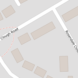

Leaflet © OpenStreetMap contributors
The heatmap indicates the level of crime in the area. The color of the heatmap indicates the crime severity and recency.
Metrics Year-on-Year
- Average area value
- 219,988.00 £Decreased by 11.41 %
- Average area rental value
- 675.00 £/moDecreased by 11.99 %
- Est rental Yield
- 3.68 %Decreased by 0.81 %
- Crime Rate
- 8.00 %Unchanged by 0.00 %
from 248,331.00 £
from 767.00 £/mo
from 3.71 %
from 8.00 %
Nearby Schools
| Name | Type | Ofsted | Distance |
|---|---|---|---|
| St Mary'S Roman Catholic Primary School, A Voluntary Academy | Academy Sponsor Led | 0.35 KM | |
| Bacup Thorn Primary School | Community School | Outstanding | 0.82 KM |
| Bacup Nursery School | Local Authority Nursery School | Outstanding | 0.82 KM |
| The Maden Community & Children'S Centre | Children's Centre | 0.88 KM | |
| Bacup St Saviour'S Community Primary School | Community School | Good | 1.44 KM |
Images
Nearby Streets
| Name | Average Price | Average Sqft | Distance |
|---|---|---|---|
| Ashworth Street | £ 80,000 | 0 | 0.00 KM |
| Greave Road | £ 0 | 0 | 0.00 KM |
| Carlton Street | £ 0 | 0 | 0.00 KM |
| Nuttall Street | £ 0 | 0 | 0.00 KM |
| Keswick Drive | £ 274,975 | 0 | 0.00 KM |
Nearby Transport
| Name | NLC | TLC | Distance |
|---|---|---|---|
| Walsden | 2665 | WDN | 9.68 KM |
Nearby Listings
| Address | Price | Type | Score | Distance |
|---|---|---|---|---|
| Clough Road, Bacup, Rossendale | £ 175,000 | BUY | 7 / 10 | 0.03 KM |
| Tong Lane, Bacup | £ 110,000 | BUY | Unknown | 0.15 KM |
| Tong Lane, Bacup | £ 100,000 | BUY | Unknown | 0.17 KM |
| Hannah Street, Bacup, OL13 9LR | £ 120,000 | BUY | 6 / 10 | 0.18 KM |
| Vale Street, Bacup, Rossendale, OL13 | £ 85,000 | BUY | 4 / 10 | 0.19 KM |
Nearby Properties
| Address | Price | Distance |
|---|---|---|
| 29 Clough Road | £ 83,000 | 0.00 KM |
| 8 Clough Road | £ 160,000 | 0.00 KM |
| 31 Clough Road | £ 197,000 | 0.00 KM |
| 3 Clough Road | £ 33,000 | 0.00 KM |
| 18 Clough Road | £ 59,950 | 0.00 KM |